Every die-hard waterfowler knows the satisfaction of finding a brand new honey hole. Hidden from plain view these hotspots can hold plenty of ducks and lots of excitement. Now that most duck hunters are somewhat tech savvy—scouting for new hunting areas has never been easier.
Maps and Photos
Topo maps and aerial or satellite imagery can be a valuable addition to your gear list, particularly if your goal is finding out-of-the-way waterfowling hotspots. And you can usually find what you need right on the internet.
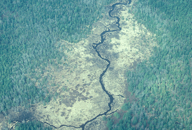
Sites like Google Earth provide detailed imagery and you can download free topo maps at usgs.gov. You can also purchase additional maps and imagery from several sources, like Garmin, that you can load right into your handheld GPS for subsequent field recon. Both imagery and maps are useful in and of themselves but when paired, the whole becomes greater than the sum of its parts.
Signs and Symbols
So what should you look for? As we’re hunting waterfowl, the short answer is: water. On a topo map, blue tint is used for water bodies and large waterways, blue lines for streams. But not all water holds ducks. A blue line with broken dots means an intermittent stream that probably won’t be productive. Solid blue lines mean year-round flow and the thicker the line, the better the odds of holding birds.
You also need to look at terrain and habitat. Green indicates vegetation (forest, shrubs), while white represents open areas such as fields and croplands. Wetlands are identified by a blue wetland symbol. Swamps (wooded wetlands) are represented…